
- Client
- DroneDB
- Sector
- Geospatial data
- Services
- Web appSoftware
The project
The project
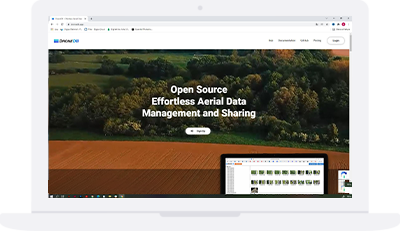
It is a secure, fault-tolerant database, designed to scale with the growing needs of companies that routinely organise, process, annotate and share aerial data. The ideal solution to index and extract useful information from aerial data, which can be indexed into a database, synced to a repository, refined and managed in a distributed, scalable way.
Makes aerial data discoverable and queryable
An innovative system that overcomes the limits of existing solutions in storing and indexing large quantities of geospatial files. This includes raw aerial images, elevation models, orthophotos, point clouds and metadata (e.g. reports, user-defined information and any other data associated with the files). The core feature of DroneDB is the ability to store and process aerial images through a single database system. The project was carried out for the US Department of Defense in partnership with Masserano Labs LLC.
Services used in this project
Let’s talk
Tell us what you want to build.
We will get back to you to arrange a first meeting, at our Milan office or online. If you prefer, call us Monday to Friday, 8:00–13:00 and 14:00–17:00 (CET).